In October 2020, amidst the biggest pandemic in recent history and when events of any and all kinds were on hold or cancelled, Slovakia was hosting one of the most important security-related events in the world as every year for over two decades. GLOBSEC Bratislava Forum has established itself as the leading platform and one of the top strategic conferences globally with who’s who of the global geopolitical landscape.
Since GLOBSEC’s guests include prominent people, VIPs, heads of states and guests of honor like Emmanuel Macron, Donald Tusk or Ursula von der Leyen, security is crucial. No aspect and no possible danger can be omitted. Not even CBRN.
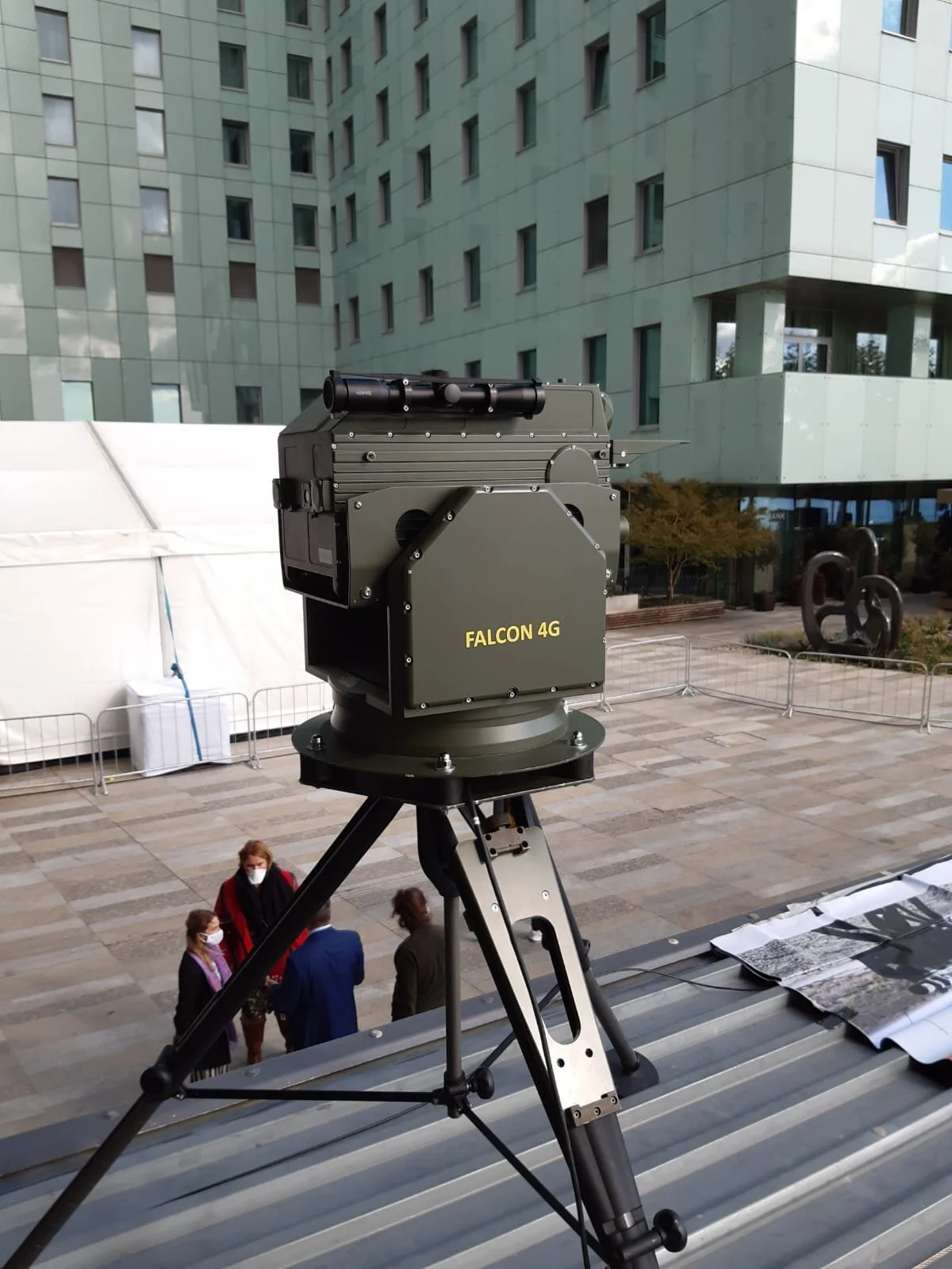
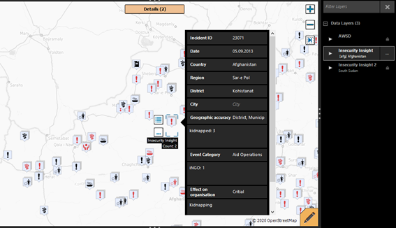
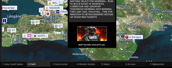
As a tool for critical missions and emergency operations, the Geographical Information Assistant (GINA) was used at GLOBSEC. This tool deployed directly in the field assists security agencies, local law enforcement and military in planning and managing security to efficiently coordinate and interact. GINA’s main role is to assist with security assessment to keep the mission safe. It allows to integrate local knowledge, geolocation data as well as output from multiple sensors to produce heat maps and data analyses. And for a top global event like GLOBSEC, with all its prominent attendees, only the best and proven technologies can be used: the finest system radios, cutting-edge drone nest, and satellite communicators along with reliable trackers. For long-range chemical reconnaissance covering area around the venue, the Falcon 4G stand-off detector was selected. Scanning continuously throughout the event, Falcon 4G was tirelessly sending data in real time and conducting chemical observation in any weather. The Falcon 4G is not only the most sensitive stand-off detector but it is also the only stand-off detector that keeps its sensitivity and reach during morning inversion, during afternoon rain or even while scanning towards the setting sun.
SEC Technologies is proud to be part of the team that protects GLOBSEC.
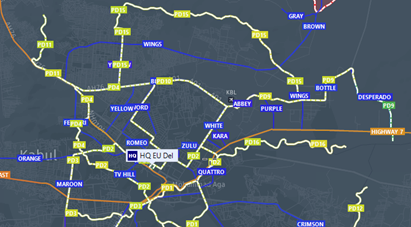
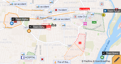
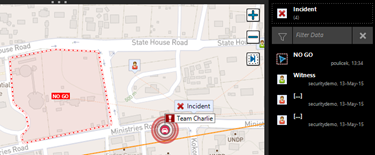
More about GINA: GINA speeds up execution time in large-scale operations as well as during day-to-day routines. The efficiency is provided via real-time situational awareness and information sharing among all engaged agencies and responders (military/police/rescuers). The ultimate tool for reaching this goal is an interactive map which provides constant real-time visibility of all involved units-entities on top of the dynamic situational data, variety of map bases and searchable context databases.
GINA helps with security assessment to keep the people running the missions safe. It allows to integrate local knowledge, network of contacts, accident geolocations, data analyses, risk heat maps and to increase the ability to make a right decision. The mission can count from hundreds to dozen thousands of units, both local and international, in different countries and time zones. All seamless, interconnected and coordinated.
GINA connects system radios, trackers, smart devices and satellite communicators with modern cutting-edge technologies like autonomous drone nest (patrolling, scanning, execution), augmented reality (HoloLens 2) and robust technologies like radars, long-range reconnaissance chemical detectors or long-range cameras. GINA is deployed and utilized in dozens of countries under MoD (army) and MoI (police, fire service & rescue service).